This project aims to establish sustainable reach-scale processes that restore and maintain floodplains, wetlands, stream channels, and aquatic habitats, reducing the influence of past mining activities while protecting downstream conditions and respecting the rights of landowners and leaseholders. Specific goals for the Grouse Creek Floodplain and Big Carmen area (35 acres, 0.9 miles of Grouse Creek, 0.26 miles of Big Carmen Creek) include improving groundwater levels during base flow periods to support riparian and wetland vegetation, doubling floodplain activation during winter for at least one month annually, increasing retention of fine sediments and organic matter, and enhancing water quality at the Grouse Creek East Fork confluence by addressing temperature, sediment, and base flow concerns. In the Grouse Canyon Reach (6 acres, 0.76 miles), the focus is on identifying and planning the remediation of anthropogenic barriers to fish passage, ensuring connectivity during critical migration periods. For the East Fork and Grouse Confluence area (80 acres, 1 mile), the project seeks to support salmonid recovery by creating and restoring habitat features that enhance riverine diversity. Objectives include increasing summer rearing habitat, winter slow-water rearing habitat (off-channels and side channels), and suitable spawning habitat for coho salmon by at least 100% in each category, promoting a more resilient and diverse aquatic ecosystem.
To address the dire effects of accumulated anthropogenic impacts and climate change on coho, and meet the goals of Governor Newson’s 30 x 30 initiative, the scale and scope of restoration must accelerate. This Project will contribute to doing so in the East Fork Scott River Watershed, which is known to support multiple anadromous fishes including coho salmon, Chinook salmon, steelhead Trout and Pacific Lamprey.
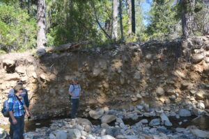
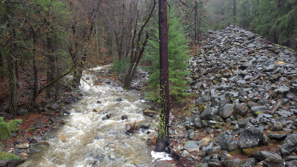
The Klamath National Forest has identified the East Fork Scott River as a focus watershed for restoration, and among their high priority actions is restoring Grouse Creek, which has been highly degraded by placer mining resulting in a loss of floodplain connectivity and associated habitats. The stream bed has incised, eliminating pools, spawning gravel, and the vegetation necessary to provide shade and food inputs to the stream, as well as decreasing water quality and lowering the water table of the former floodplain. Fish have no refuge from high stream velocities and cannot persist without access to missing slower water in side channels, oxbows and wetlands on the floodplain.
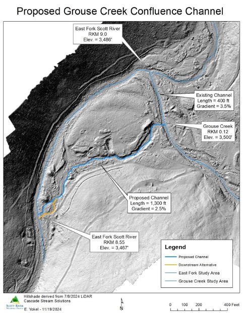
Utilizing a Technical Advisory Team including key personnel from USFS, NOAA, Quartz Valley Indian Reservation, consultants, CDFW and the Regional Waterboard, and the Scott River Watershed Council will assess baseline conditions, develop restoration options, select preferred options, and complete 100% designs for the preferred option. The options to be considered for Grouse Creek’s depositional valley are a Stage-0 treatment and more low tech alternatives.
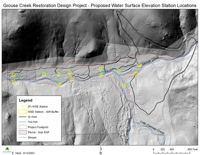
SRWC is conducting critical groundwork to inform the planning and design of restoration efforts in the East Fork and Grouse Confluence reach. As part of this initiative, SRWC is monitoring ambient and cold-water temperatures to identify vital cold-water inputs that support aquatic habitat health. Additionally, we installed 12 water surface elevation monitoring stations to collect precise data on hydrological patterns. This work will provide essential insights to guide effective habitat restoration and water management strategies. Below is our wonderful project manager, Peter Thamer.