The Scott River Watershed Council is working collaboratively with Scott River Tailings landowners to explore options for reconnecting Sugar Creek Ranch to the Scott River, allowing currently isolated waters to once again support fish movement and habitat in the mainstem river. SRWC, Stillwater Sciences, the Yurok Tribe and Cal Trout are looking at ways to combine efforts to make this historic opportunity a reality. Please note the design sketch below is merely for conceptual purposes.

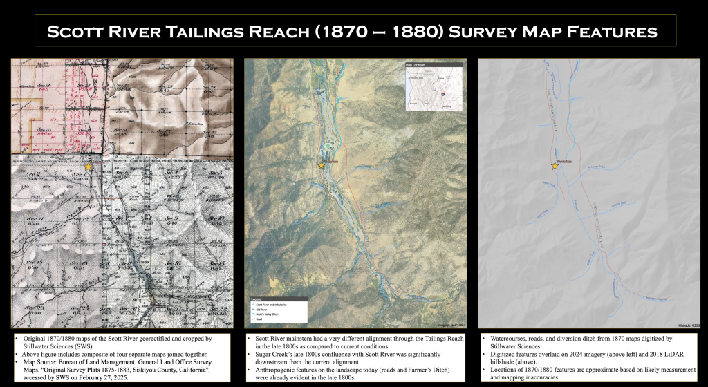
Historic survey maps from 1870–1880 (see below) show that the Scott River once followed a very different alignment through this reach of the Scott River, shows Sugar Creek entering the river much farther downstream than it does today. These maps also document early roads and diversion infrastructure that shaped how water moved across the valley before the impacts of mining. By comparing these historic conditions with modern aerial imagery and LiDAR, we gain critical insight into how the river functioned before extensive modification—information that now helps guide restoration planning, reconnection of water, and recovery of habitat in one of the most altered sections of the Scott River.
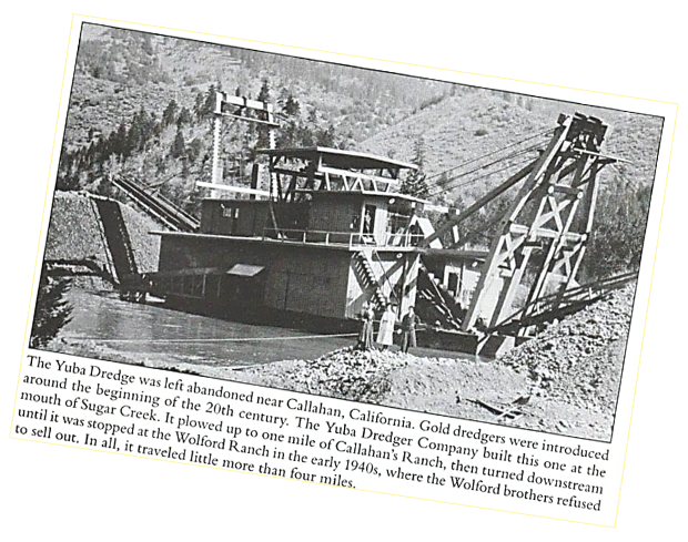
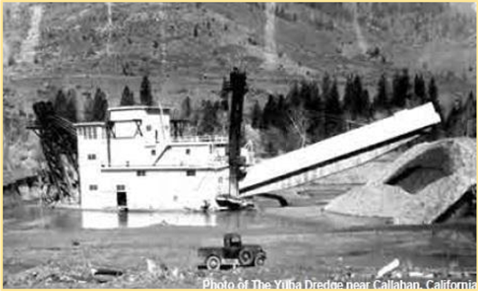
In the late 1930s, the Yuba Dredger arrived in Callahan as a marvel of its time, each massive piece hauled over the old Stage Road from Yreka and assembled into what locals simply called “The Boat.” Built in 1936 and powered by electricity that was generated on the South Fork of the Scott River. This floating dredge dug its own ponds as it moved, reshaping the Scott River corridor in pursuit of gold. At its peak, it averaged nearly $10,000 a week and operated until 1951, pausing only during World War II. By the time it shut down, the river had been fundamentally reworked, straightened, simplified, pushed it to the eastern side of the valley, and stripped of much of its natural function.

To view a slide deck from a past presentation, please click this link.