
The Scott River Watershed Council (SRWC), in partnership with Stillwater Sciences and the Quartz Valley Indian Reservation, is advancing a critical fish passage and habitat restoration planning effort at the confluence of Shackleford Creek and the Scott River. This project is part of a broader, watershed-scale initiative focused on improving water management, ecological function, and long-term resilience of the Scott River Basin.
The Shackleford Creek confluence is a key location for salmonid migration and rearing, yet existing channel conditions limit fish passage, especially during low-flow periods. Through this project, SRWC and Stillwater Sciences are developing restoration designs that address these barriers while working with the river’s natural geomorphic processes.
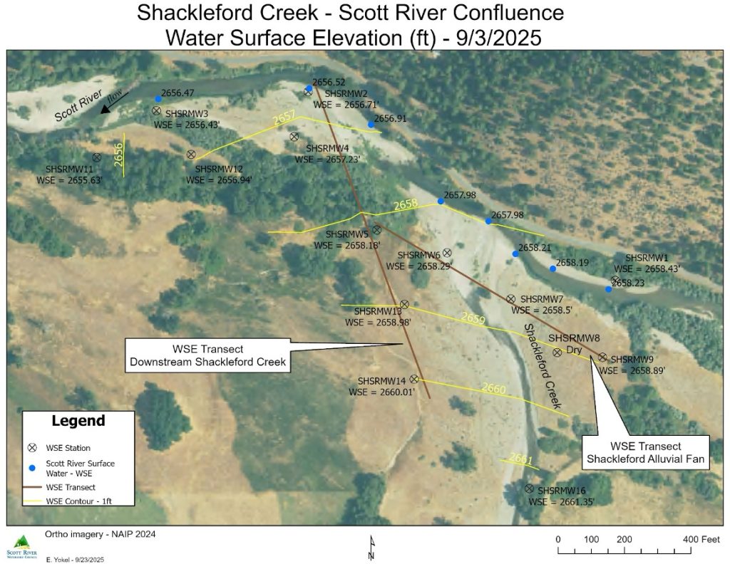
The work includes a comprehensive desktop assessment of historical and current channel conditions, followed by development of a digital terrain model, hydrologic and hydraulic analyses, and geomorphic evaluation. Using these tools, the project team will design and evaluate multiple restoration concepts to improve fish passage and habitat connectivity. These alternatives will be reviewed with SRWC and project stakeholders, leading to selection of a preferred approach.
The preferred restoration option will then be advanced to a 65% engineered design level, providing a strong technical foundation for future permitting, funding, and implementation. The designs will focus on improving salmonid access between Shackleford Creek and the Scott River while enhancing floodplain connectivity, channel stability, and long-term project sustainability.
This planning and design effort represents an important step toward restoring ecological function at a priority site in the Scott River watershed and supports broader recovery goals for native salmon and steelhead populations.
To read the Basis of Design Report, including the 60% designs, click here.
Shackleford Creek & Scott River Confluence – Water Surface Elevation Monitoring